


MASON CITY 1 Voting District, Mason County, Illinois
About
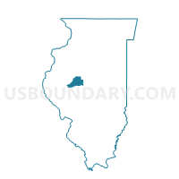
Outline

Summary
| Unique Area Identifier | 573527 |
| Name | MASON CITY 1 Voting District |
| County | Mason County |
| State | Illinois |
| Area (square miles) | 2.04 |
| Land Area (square miles) | 2.04 |
| Water Area (square miles) | 0.00 |
| % of Land Area | 100.00 |
| % of Water Area | 0.00 |
| Latitude of the Internal Point | 40.21717030 |
| Longtitude of the Internal Point | -89.70602780 |
Maps


Graphs
Select a template below for downloading or customizing gragh for MASON CITY 1 Voting District, Mason County, Illinois


Neighbors
Neighoring Voting District (by Name) Neighboring Voting District on the Map
- ALLENS GROVE 1 Voting District, Mason County, IL
- MASON CITY 2 Voting District, Mason County, IL
- MASON CITY 3 Voting District, Mason County, IL
- PENNSYLVANIA Voting District, Mason County, IL
- SALT CREEK Voting District, Mason County, IL
Top 10 Neighboring County Subdivision (by Population) Neighboring County Subdivision on the Map
- Mason City township, Mason County, IL (2,633)
- Allens Grove township, Mason County, IL (586)
- Salt Creek township, Mason County, IL (228)
- Pennsylvania township, Mason County, IL (206)